As we walk towards the bridge you will notice the stream called Ladybrook on the right. We will come back to this important tributary of the Great Ouse when we reach Newton Lane.
As a child Malcolm Church lived in Bridge Street and his father enjoyed a bit of poaching as Malcolm remembers:
Turvey Gas Works
After the three cottages numbered 41 – 43 we come to two new houses built in 1988 on the site of the former Gas Works. The Turvey Gas Works Company was formed in 1867 and in 1930 was bought by the Olney Gaslight Coke and Coal Company. Turvey had gas street lamps but you would not say the village was well lit. Most cottages had gas for lighting but generally in only one room. In 1936 the Northampton Gaslight Company bought the site. It must have had a good number of employees as local papers show that it had a football team playing in a local league. The Company eventually went into liquidation and in 1974 the last two sheds were removed from the site. Electricity had been in Turvey since 1935.
TCH
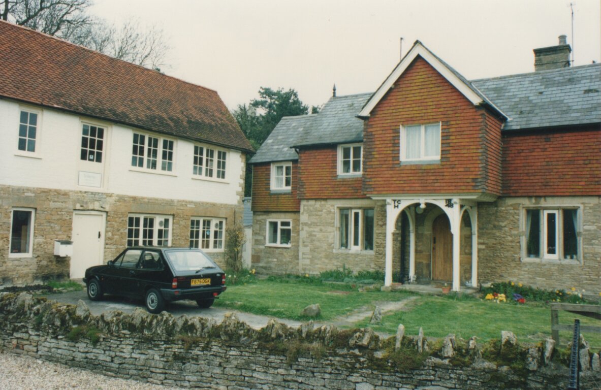
TCH 1848 Bridge Street
Number 44 Bridge Street was formerly the village Post Office. Arriving at number 46 we see the front gables marked with the letters TCH to reflect that the houses were built under the direction of Thomas Charles Higgins in 1848.
Mrs Bailey’s Ice Cream
Number 48 Bridge Street was well known between the two world wars as the home of Mrs Bailey, whose homemade ice cream was famous for miles around, having won prizes at Olympia. At this time it was the only shop that opened on a Sunday and queues would stretch across the bridge. Later, the building would become a ‘Mace’ store, selling groceries and general goods before becoming a residential property.
Puddles Close
Next, we come to the Grade II listed railings and former gate to Turvey House. This was the original entrance, to be replaced by the current entrance in the mid 19th century. The area on the other side of the railings is known as ‘Puddles Close’, for obvious reasons!
Turvey Bridge
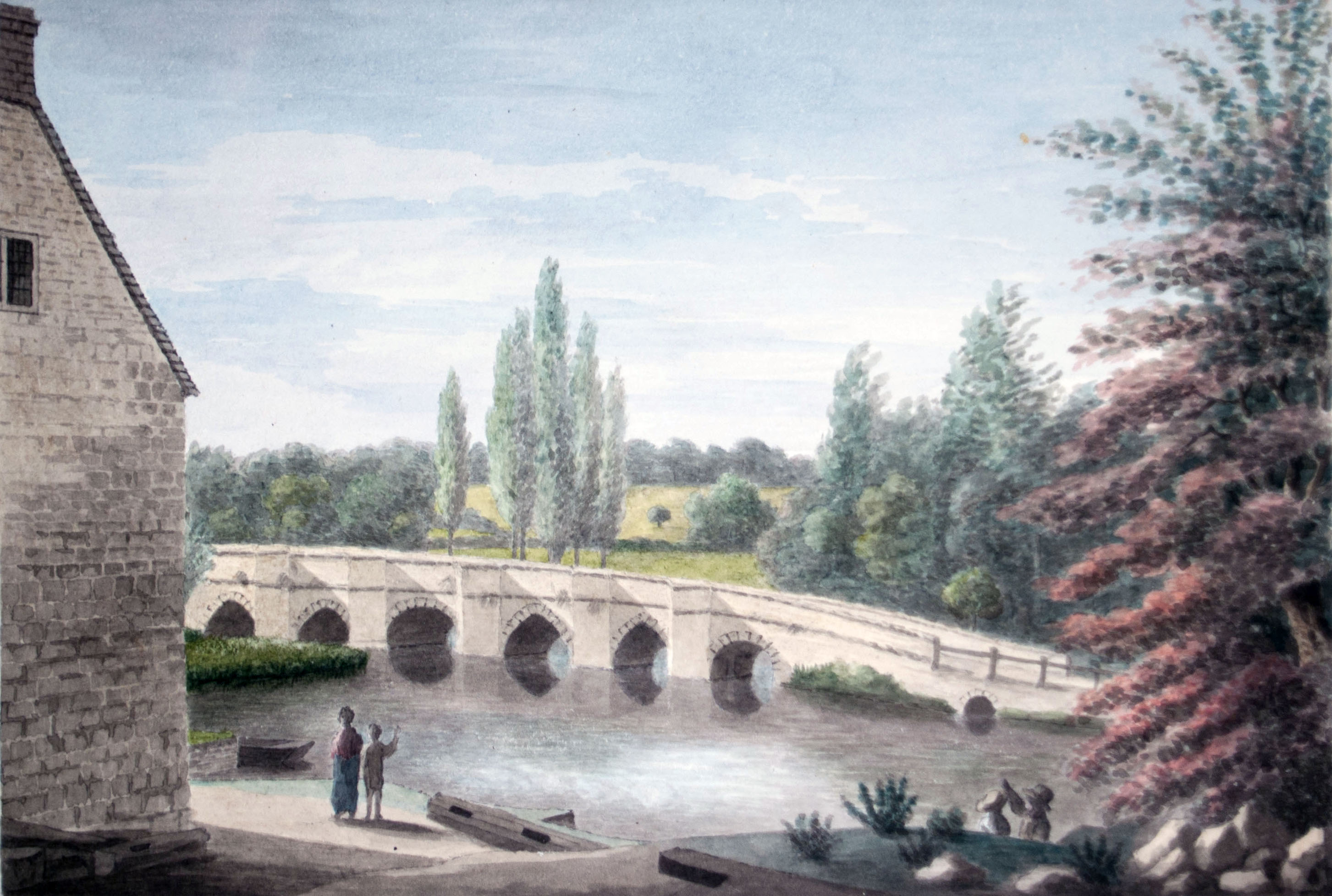
Bridge over The Ouse. Watercolour by John Higgins. © J. Longuet Higgins

Turvey Bridge. Watercolour by John Higgins. © J. Longuet Higgins.
Looking over the north side of the bridge one might see some bricks protruding from the wall. These were once steps leading down to Sam’s Garden, now known as Sam’s Island. This was a very popular fishing spot. Indeed Turvey, at one time, attracted many fishermen who came to the village with their families for a holiday. The island (and fishing rights!) are still owned by the Longuet Higgins family.
The part of the river below Turvey House is called the ‘shallows’. Here, in summer, the river may be crossed on foot and was the starting point for young people to enjoy as swim as remembered by Dave Hilson:
This is thought to be the first crossing of the Great Ouse to be used in Turvey. The earliest recorded mention of a bridge was in 1136. In the early 1400’s a chapel was built to collect alms and money for the upkeep of the bridge. A record exists to show that the ‘Hermit’, John Combes, lived in the chapel in 1405 (i). The bridge is in two sections linked by a raised road causeway. The Buckinghamshire side section was a long foot causeway consisting of 22 planked and 2 stone arches. Responsibility for the upkeep of the bridge rested with the Lord of the Manor, a position originally held by the Mordaunts.
In 1753/4 a ‘Bedford to Olney Turnpike Trust’ was formed by an Act of Parliament, outlining responsibility for the upkeep of the bridge with income from tolls and the Lord of The Manor. When the village was put up for sale by the 5th Earl of Peterborough in 1786 no mention was made of the bridge. In 1795, severe flooding washed away much of the Buckinghamshire side of the bridge. Eventually, John Higgins, the Trust and the Parish produced funds for the building of additional arches.
A turnpike was a spiked barrier in the road, high enough to stop horses jumping over. Once the toll had been paid, the barrier was opened by turning the spikes until they were flat against the road.
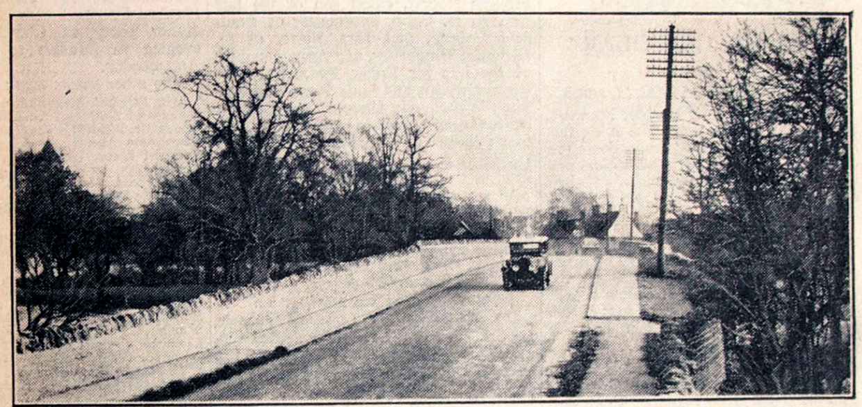
Road bridge in 1932 after widening
By 1828 the Turnpike Trust had constructed a “low modern carriage road”, using stone from the quarry in Baker’s Close, we can see on the southern side of the bridge. At this time it was referred to as a ‘pack horse bridge’ with recesses for pedestrians. Responsibility for the maintenance of the road passed to the Counties of Bedfordshire and Buckinghamshire. By 1930 it was clear that the bridge needed widening. At a cost of £ 16,000 the bridge was widened to its present 11 arches with a 27m causeway between 4 and 7 arches. The bridge is now 209m long and 10m wide. The remains of the raised walkway can still be seen in the first meadow on the left when leaving the village. You can learn more about Turvey Bridge by reading Janet Goodland’s article.
(i) Hermits and Anchorites of England. Rotha Mary Clay (2014). Appendix C
We cross the road to the south side of the Bridge, to Stop 6, Jonah and the former Mill.


No Comments
Add a comment about this page