There cannot be many residents of Turvey who have not seen flooding in the village; the most recent floods at Christmas 2020, when the country was in lockdown for the coronavirus pandemic, drew many spectators who had little else to do on a winter’s morning. Most villagers will also have stopped to gaze at the flood markings on the stones in the wall of the Three Fyshes, and wondered at the height the waters reached in 1797, 1823 and 1947. The river is an important feature of the village; indeed it is probably the reason for a settlement here originally, and, not surprisingly, the records show that it has flooded and affected life in the village on a number of occasions over the centuries.
Early records of floods in Turvey
The earliest mention of flooding we have is in a monograph titled ‘The Hermit of Turvey Bridge’[i] (Littler 1999) which suggests that the area would have been subject to flooding in the 15th century, and also references the ‘great flood’ in 1823. The fact that the bridge had a foot causeway, mentioned in the first Lord Mordaunt’s will of 1560, and shown on a map in 1783 suggests that flooding was a common occurrence. Floods in 1795 were so severe that John Higgins gave money to repair the bridge[ii]. Whilst living at Turvey Abbey, he wrote about the flood to his sister Sarah in Grays, Essex on 14th February 1795
that has kept us prisoners at home… We have had such an inundation of Water and Ice as was never before remembered the water was impassible between Turvey and Brayfield near three days likewise at Newton, Olney and every other place in this County… to give you some Idea of the situation of Turvey, above half the Houses was all day on Monday and Tuesday last flooded knee deep. I have one House tumbled down, have about Twenty yards of my Garden Wall washed down,… the News came of Turvey Bridge having fell, likewise all communication on horseback is cut off between Olney and Emberton a great length of the bridge having been swept away… Harrold Bridge, Wellingborough Bridge and a great many more impassible. On Thursday Morning Our River made such an appearance as was really terrable, nothing but the top of the Bridge was to be seen… At Bedford there has been damage done to the amount of Five or six thousand Pounds the Water was so high as to flood the Churches particularly St. Pauls a considerable depth.[iii]

Turvey Bridge over the Great Ouse from the Mill, painted by John Higgins early 19th Century
The 1797 floodThe earliest plaque on the wall of the Three Fyshes shows the water level on 26th September 1797, some 113 cm above the footway. We do not know exactly what caused this flood, but the Hampshire Chronicle of Saturday 30th September 1797 reported ‘Monday morning at two o’clock, one of the heaviest storms of rain, accompanied by thunder and lightning, came on at Windsor that was remembered: the water ran down in torrents, and the roads were rendered impassable’. The paper included an extract of a letter from Woburn, Bedfordshire describing the storm ‘About six o’clock on Monday morning several of the inhabitants of the villages in the neighbourhood of this town, whole houses lay low, were alarmed with the water pouring into the lower parts of their houses….The Manchester ,Leeds and Holyhead mails for London did not arrive at their usual time, and we soon learnt that the bridges of Newport Pagnel (sic) were impassable….although the water had sunk several feet it was five feet when they passed through.[iv]’ The storm was reported in a number of other publications, including the Staffordshire Advertiser, Derby Mercury and Oxford Journal.
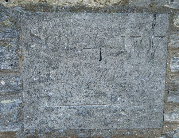
Stone on Three Fyshes showing the water level of the 1797 flood.
Floods were obviously a major topic in correspondence between villagers and their friends elsewhere – a letter to John Higgins in April 1809 asks how Turvey Bridge survived the flood.[v]
1823 – the great flood
The second plaque records the water level on 1st November 1823, 125 cm above the footway. This flood damaged the bridge, and required repairs costing £120 8s 1d. The flood followed another storm – the Northampton Mercury of 8th November reported ‘The effects of the storm last week for many miles around this place were very disastrous. Trees were blown down in all directions and in many cases the roads were rendered impassable. The mail and other coaches were detained for several hours at Newport Pagnell on Saturday morning. In consequence of the flood which was greater than had been seen for some time past……the inhabitants of Stony Stratford were thrown into the greatest consternation, in consequence of the water entering their houses so rapidly as scarcely to allow some families time sufficient to get out before the walls of their cottages fell down…’.[vi] Bedford was also badly flooded, and the Saturday market was suspended.
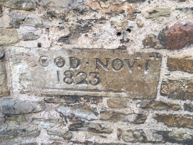
Marker stone on Three Fyshes showing the level of the 1823 flood
More 19th century floods
Floods in Turvey were not only the result of bad weather causing the Upper Great Ouse to rise. In 1876, the Bedfordshire Mercury reported a meeting of the Highway Board at Bedford where it was reported that ‘The Turvey Brook’ (Ladybrook) had overflowed in the previous summer. The brook had been inspected by a sub-committee who found it ‘very much blown up; its passage was considerably obstructed. At one point a large elm tree was actually growing in the brook and materially impeding the free flow of the water.’[vii] The Board ordered the brook to be cleared out, and if necessary, larger culverts be erected. They did not approve raising the road as it would affect the ditch alongside.
The local press reported floods at Turvey frequently in the 19th century. The Northampton Mercury September 25th, 1880, reported ‘On Friday, Saturday and Sunday last, the river on both sides of Turvey bridge presented the appearance of a broad lake, stretching as it did across the meadows, and rising so high as to partly cover the highway’. [viii] On December 3rd 1881, the same paper reported ‘Another storm raged in this neighbourhood on Saturday night, accompanied with a heavy downpour of rain, which caused the river Ouse to overflow the road between Turvey Bridge and Cold Brayfield, delaying foot passengers for a few hours.’[ix]
The tragic consequence of a flood
The floods presented a significant danger to villagers. A report of the funeral of Mrs Mary Wesley in 1935 recorded that she lost a son of school age who drowned in a flood at Turvey Bridge. Death records indicate that the victim was probably William Wesley of Cold Brayfield, who died aged 10 in December 1900. Severe floods were recorded in the area at the time.
Local people attributed their bad health to the frequent floods; in February 1905 Miss Mary Farrer of Brayfield House wites ‘Brayfield people in these dreadful floods always get chills’ …’last week we could not pass Turvey Bridge’. [x]
Early 20th century floods
By this time, floods appear to have been a permanent feature of the village; Bedfordshire Archives holds a photographic postcard published by Ada Wright of Turvey, titled ‘The Great Flood At Turvey on 29th April 1908’, showing the Three Fyshes with the road covered in water[xi]. Despite the title, the water level is nowhere near any of the plaques on the wall. The Archives also contain a greetings card from Turvey from about the same time – effectively a montage of five postcards, the central one being a view of the bridge across flooded fields. [xii] Floods continued to be mentioned in letters; in January 1928 Gertrude Longuet-Higgins reported ‘Jonah is covered up to his eyes’. [xiii]
Today we enjoy early warning of potential floods – this was not so in 1912. The Ouse flooded badly along its length in late August, and the Bedfordshire Mercury recorded ‘A telegram was received in Bedford on Monday from the Buckinghamshire authorities asking that the floodgates be opened as there was a tremendous amount of water to come down’.[xiv] The Bedfordshire Times and Independent reported ‘The Turvey Brook became a little torrent and the river overflowed into the meadows – the worst August flood we have seen…..The Brayfield road was impassable’.[xv] The report continues, detailing the devastation the flood caused to crops and fruit trees. It concludes ‘Prayers for fine weather were offered in the parish church on Sunday, when the Rev W Bishops of St Sepulchre’s Church, Northampton, officiated in the absence of the Rector, the Rev F.W. Fulford, who is taking a short holiday in Scotland’. [xvi]
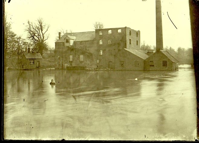
Floods at The Mill before the chimney was demolished (1932)
In 1919 flooding damaged the river bank, meaning that the mill was unable to operate. John Longuet-Higgins and William Bamford were involved in repairing it.[xvii]
The Bedfordshire Times and Independent, 8th January 1926, reported ‘The floods came up rapidly at Turvey on Saturday morning and spread for miles over the low-lying fields between Turvey Bridge and Cold Brayfield’.[xviii] The same paper reported on 3rd June 1932 ‘Owing to the continuous rain of Saturday and Sunday the floods reached an unusually high level again on Monday and before evening the road between Turvey and Brayfield was impassable to pedestrians. Most motor-cars were able to pass with care, and the houses near the Bridge escaped last week’s experience by only a few inches.’ [xix] Turvey made the national newspapers on that occasion – the Daily Herald (the paper which in due course became The Sun) ran a photo of the bridge and flooded fields under the heading ‘New Lake District created in Midlands[xx]’. An article in Turvey News 1998 indicated that the photo was of Albert Cockings driving his horse and cart through the flood from Turvey towards Cold Brayfield.

New Lake District Created in Midlands
Turvey makes the national press
The east coast suffered serious flooding in January 1939, and most newspapers reported the plight of people in Ipswich who had been without food and drink for two days. Several regional papers, including the Liverpool Echo, Yorkshire Evening Post, Midland Daily Telegraph, Cambridge Daily News and Leicester Mercury supplemented their reports of this with a list of other places which had been badly affected, including ‘The Bedford-Northampton road at Turvey Bridge is flooded to a good depth, and two lorries are marooned in the water’[xxi]. The Bedfordshire Times and Independent gave more detail. The flooding occurred after a heavy snowfall and rapid thaw – ‘one of the highest floods for many years occurred during Friday and Saturday at Turvey, when the main road between Turvey Bridge and Cold Brayfield was flooded to a depth of between two and three feet. During Friday afternoon and evening several small cars stopped in the deepest part and had to be hauled out. After dark a lorry loaded with bricks stopped in the middle of the road and remained there through the night. Early on Saturday morning another large lorry attempted to pass it and got into deep water, completely blocking the road.[xxii] ‘. The blockage was cleared on Saturday afternoon. The article concluded ‘ “Jonah” was submerged nearly up to his shoulders. Beyond the flooding of cellars etc, no serious damage was reported.’
Another flood in the same year was also reported by national and regional titles; the Daily Herald reported on October 20th 1939 ‘A lorry crashed through the parapet of the flooded Turvey Bridge and plunged into the river. The driver jumped and saved himself’. [xxiii] The Western Morning News reported ‘Felmersham, Harrold and Radwell were isolated with people living in upstairs rooms’ [xxiv] and a large number of animals were drowned at Odell and Felmersham. The Rector of Turvey, C A B Allen, wrote to Henry Hugh Longuet Longuet Higgins ‘It’s up to the Gas works in Turvey – higher than I’ve ever seen it here’[xxv]. This latest flood prompted a letter to the Bedfordshire Times suggesting that notice boards be erected on certain roads to advise motorists of floods and alternative routes.
The 1947 Flood – Icebergs in Turvey
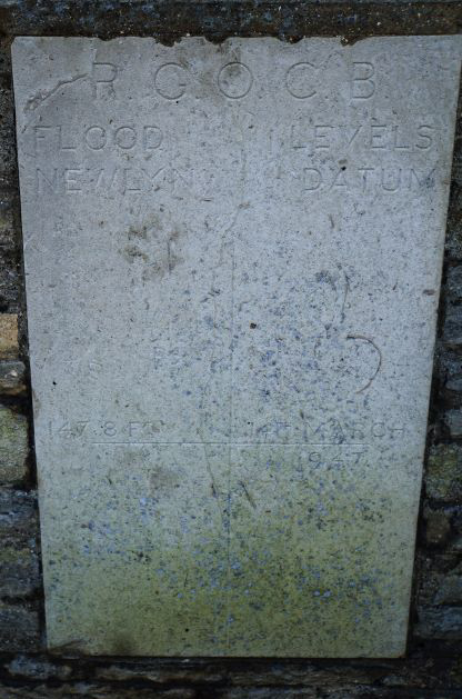
Stone on Three Fyshes marking the level of the 1947 flood
The third plaque on the wall of the Three Fyshes commemorates the flood of 14 March 1947, when the water level rose to 57 cm above the footway. This flood followed a period of bad weather; the Bedfordshire Times reported ‘The thaw following the arctic-like weather of the past two months was followed in Bedfordshire…by record floods, and large areas were …. under several feet of water. Householders and shopkeepers were marooned, and highways and byways over-run.’[xxvi] The Summer 1998 edition of Turvey News included some personal memories of this flood.
Francis Bailey recalls that his father Frank Bailey made the last journey back from Olney in his bus during the time of the 1947 floods. He could judge from the water level against a certain tree whether he would be able to get the bus through the flood and over the bridge into Turvey
Dereck Cockings remembers that when the ice and snow began to thaw there were great icebergs flowing along the river and they crashed into the arches of Turvey bridge. They were standing up on end and blocking the flood water and the icebergs were going off like canons when the pressure of water broke them against the stone arches
I came out of Ladybridge on my bike to deliver the morning papers to find that that particular night it had frozen solid as the water had receded. All down Bridge Street the receding water had been frozen to the walls about 18’’ high up the walls, from each side of the road, from the houses to the middle of the road, unbroken ice – it was like a saucer, it was absolutely incredible. It was still flooded at the Cold Brayfield side of the river as there wasn’t any traffic to break it up’(D. Cockings)
There is a mark in my shop showing the water level at that time eighteen inches above flood level (L. Savage)
Ladybrook Floods
The brook also flooded a number of times in the 20th century – there are anecdotal reports of significant floods in 1922, 1950 and 1980, one of which is reputed to have reached the site of the telephone box on the village loop. In an interview for our Voices project, Nigel Hartwell recalls Ladybrook flooding in July 1974, and pushing a wall in Bridge Street over.
An article in Turvey News Christmas 1992 edition reports the 1980 brook flood. It flooded Len Savage’s building yard at the bottom of Newton Lane (now Winterbourne and Ladybrook Cottage) and demolished a stone wall on the opposite side of Bridge Street. The report continues
The brook, after going under Bridge Street, goes under a channel running behind three houses and at that time also the gasworks; then through a culvert to enter the river (the entrance to the river has since been changed). Behind these houses a stone wall held back the water. The water in the channel was also flooding; the houses were being attacked from the back and front, water was coming up the manholes in the back gardens and up the wastepipes in the downstairs bathroom [of the first house in Bridge Street]. The turbulent water… went through the house with such force that it pushed the refrigerator over.
Ironically, the same house was again flooded in the same way in 1983; fortunately changes to the channel and the place the brook enters the river have prevented more floods in this area.
Ladybrook flood at the bottom of Newton Lane outside Len Savage’s workshop in 1983
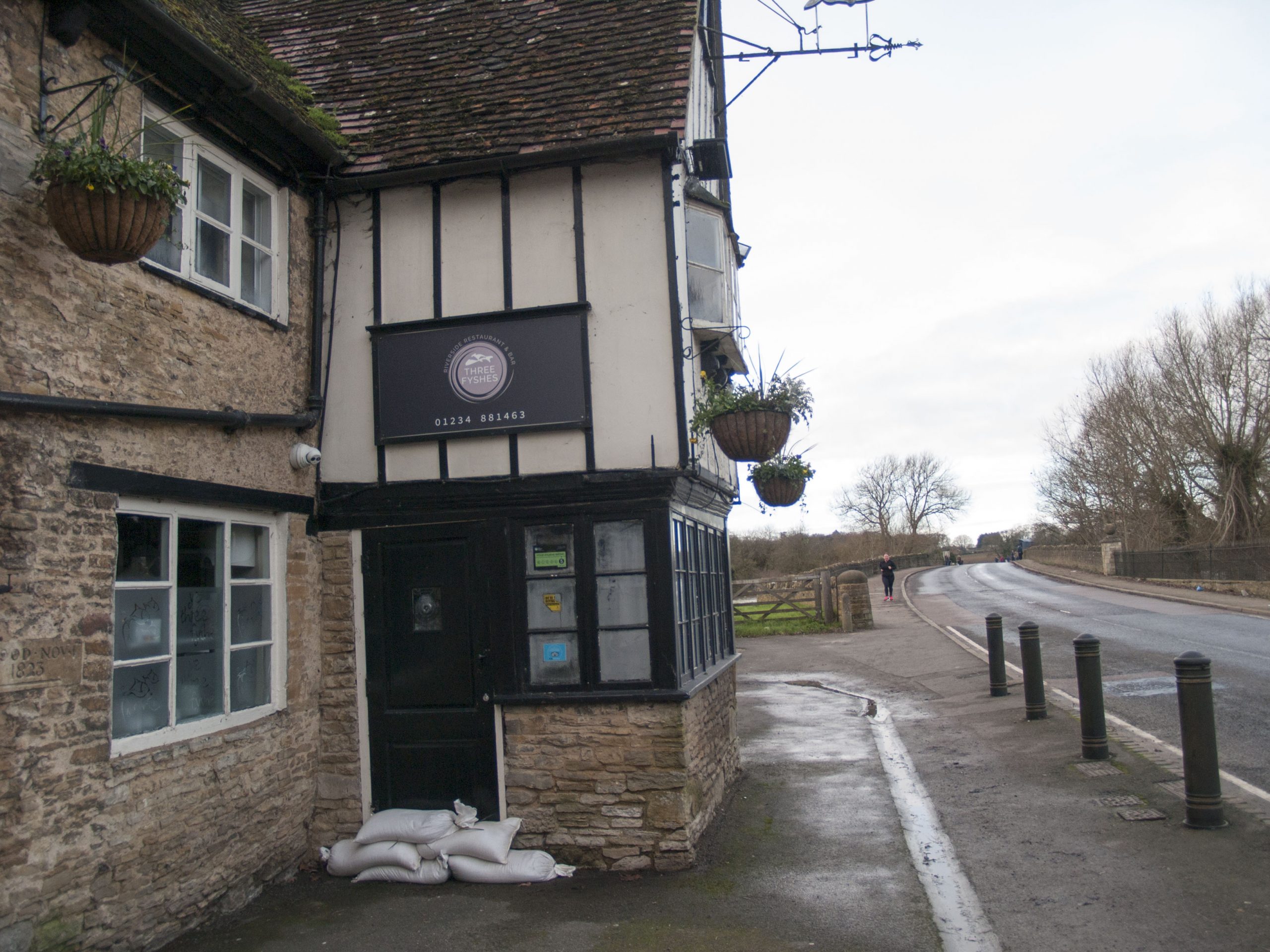
Sandbags in Norfolk Road
The last week in September 1992 saw another flood. The emergency services were out in force this time; residents in Norfolk Road were visited by the police telling us how to make sandbags from plastic carrier bags and garden earth, and to turn off the gas and electricity if the water reached our doors and the school was prepared as an emergency shelter. As Norfolk Road is one of the higher roads in the village, it is difficult to imagine what the rest of the area would have been like if we had to do that! Charles Wincott, landlord of the Three Fyshes appeared on television, showing the effect on his cellar.
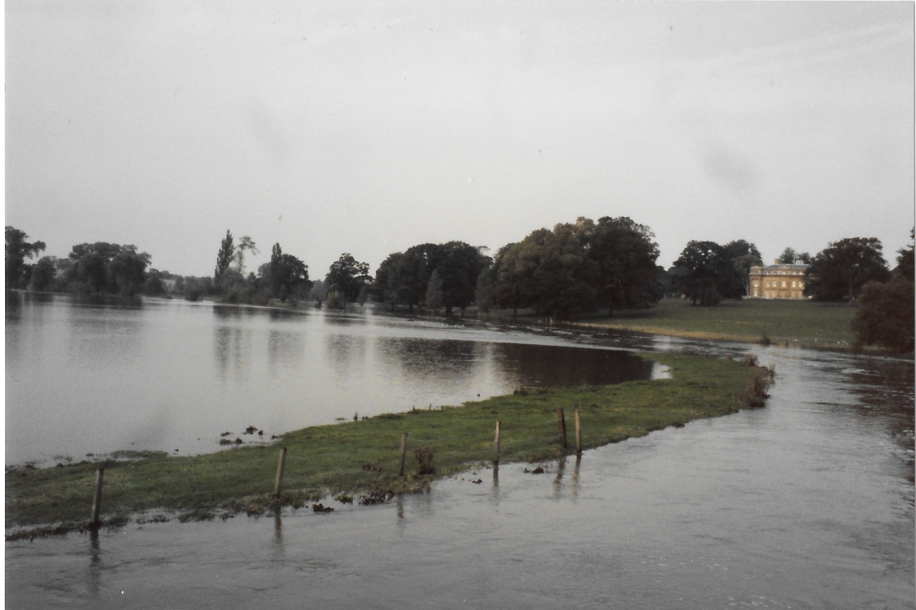
Turvey House and River Ouse in flood September 1992
The effects of this flood were significant elsewhere in the Upper Great Ouse catchment area, and in March 1996 the National Rivers Authority consulted on options to improve flood protection, maintain the flood plain and upgrade river control structures.[xxvii]
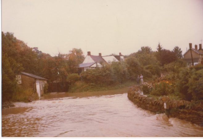
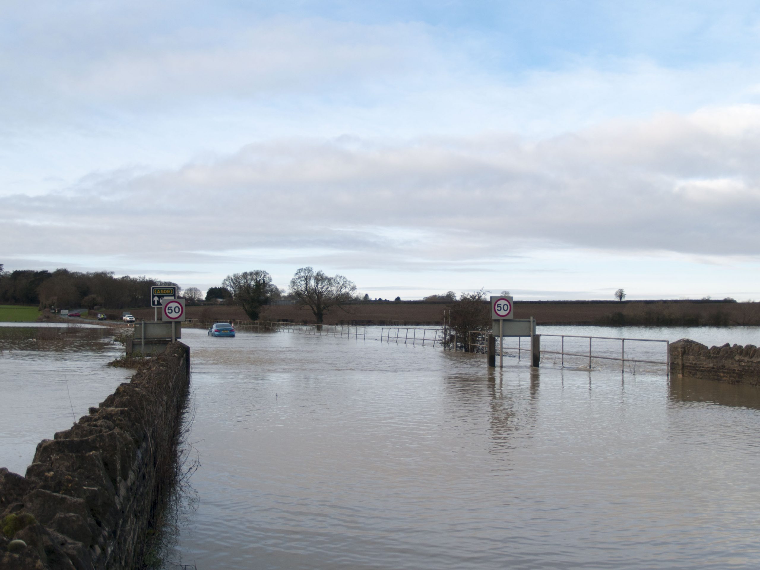
There was another major flood at Easter 1998. Heavy rain on Thursday 9th April and Good Friday 10th April resulted in the highest levels seen in the River Great Ouse since the 1947 floods. There was extensive flooding with loss of life and significant damage to properties across central and eastern England; Northampton and Newport Pagnell were particularly badly affected. In Turvey, the fields were flooded and the road to Cold Brayfield was impassable. There was flooding in Bridge Street to the bottom of Mill Lane and Newton Lane, with some properties affected. This time the village hall was set up as an emergency shelter. Photos show cars driving through deep water – in the latest floods, modern car electronic systems meant that those who tried got stuck!

Bridge Street flood

The Mill showing Jonah submerged to his shoulders

Road towards Cold Brayfield

Flooding at The Three Fyshes
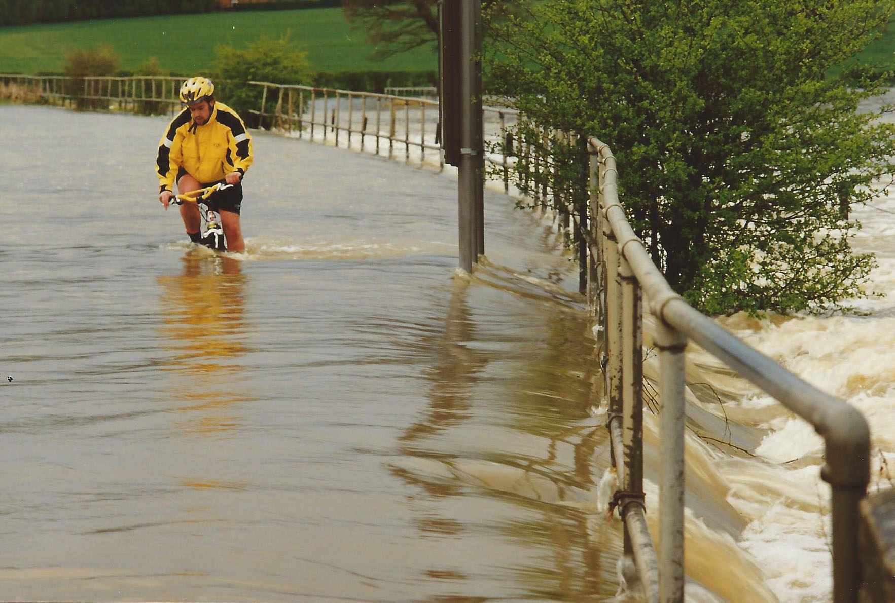
Braving the flood!
Flooding at the MillThe Government commissioned an independent assessment of the performance of the Environment Agency in responding to the 1998 floods.[xxviii] The report contains case studies of the effects of the flood at a number of locations, including Newport Pagnell and Clapham; at both locations a number of properties were flooded. As a result of the assessment, a number of improvements to the way in which flood warnings are issued, the emergency response procedures, and the management of flood defences were recommended. Around this time, recording equipment was installed at Turvey sluice; levels now are recorded every 15 minutes and published here.
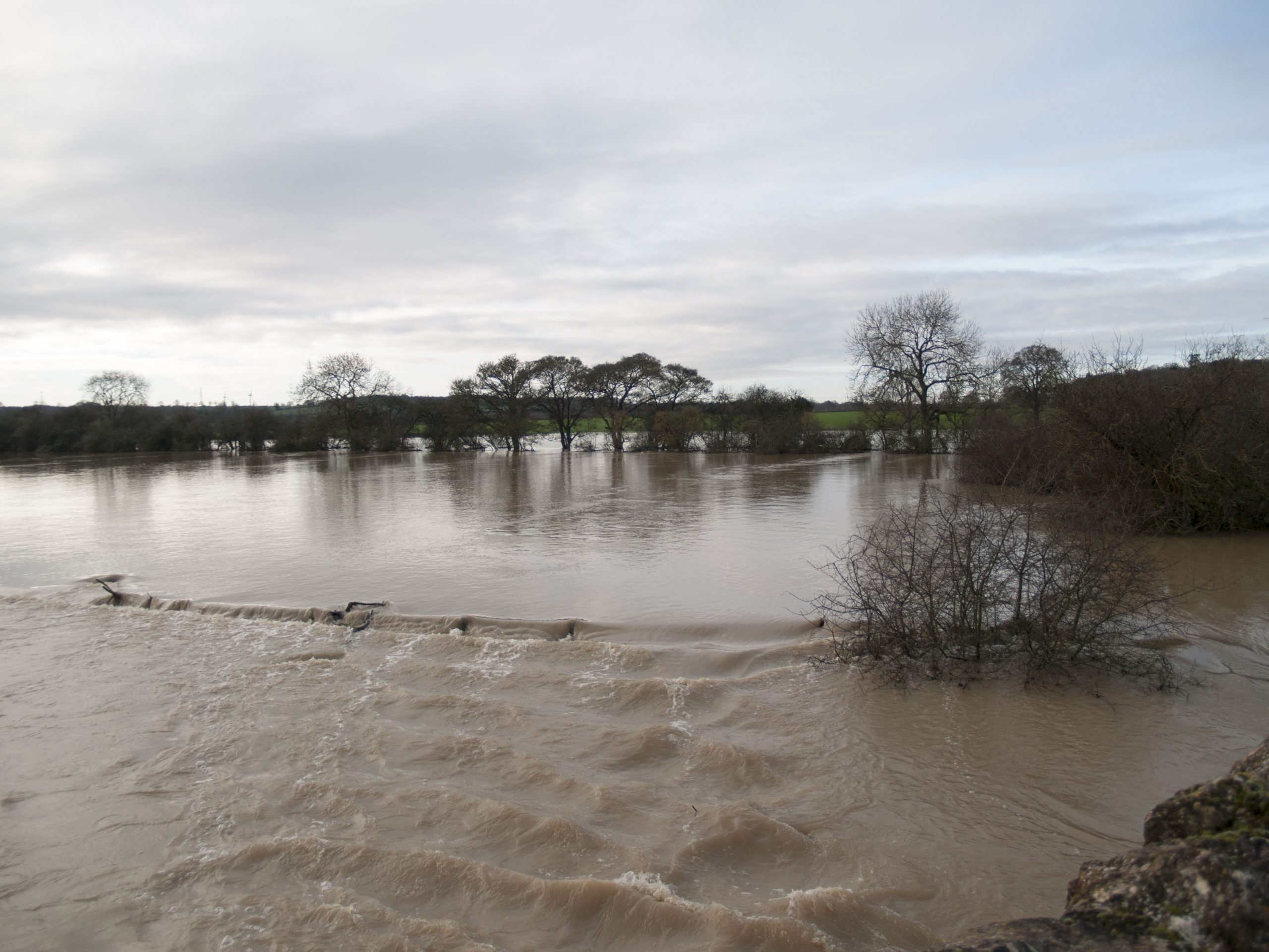
The latest floods
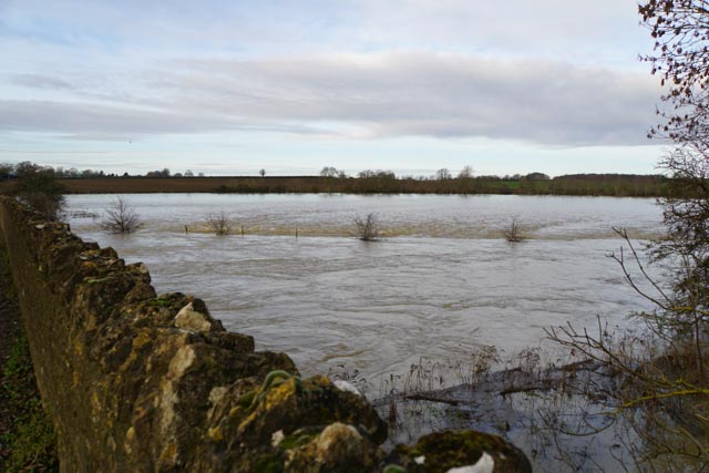
This brings us to the floods of Christmas 2020. There had been heavy rain for a number of days, and on Christmas Eve the river rose and by 8pm had covered the road. Once again the emergency procedures were instigated, and sandbags were delivered to houses in Bridge Street and the Mill. The Village Hall was opened as an emergency centre. The flood peaked at 2.30am on Christmas Day; the maximum water level recorded at the sluice was 1.75m above the datum – about 1.5m above the normal level. This is the peak level that has been recorded since the equipment was installed. Fortunately, on the Turvey side of the bridge the flood did not quite cover the road, so whilst some water breached the defences and flooded garages and cellars, there was less damage to properties than in 1998. At the time, Turvey was under ‘Tier 4’ Covid pandemic regulations which meant that no household mixing was allowed, and overnight stays away from home were forbidden. As a result, most Turvey residents were at home without Christmas guests, and on Christmas morning many walked to the bridge to survey the new lake which was now a feature of the landscape.

Flooding at the Mill
Fields to the south towards Cold Brayfield
The Road to Cold Brayfield
Sandbags at The Three Fyshes

The Mill
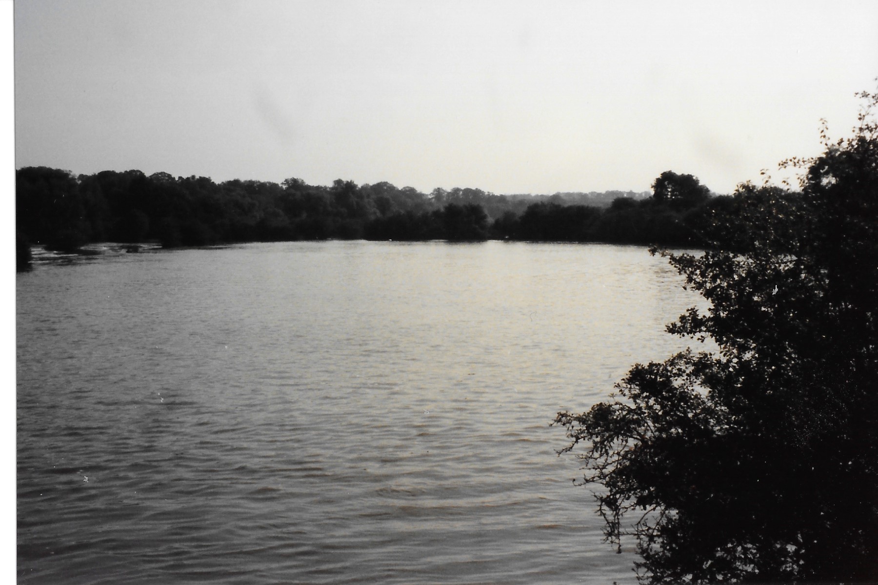
Fields looking north towards Cold Brayfield

Turvey House
Modern communications, weather forecasting techniques, improved river management and well-rehearsed emergency procedures mean that today we have more warning of floods than our predecessors did, and are better able to prepare and protect life and properties. However, nature’s processes do not change, and the scenes of flooding we see in Turvey today must be very like those back in the 18th and 19th century.
[i] The Hermit of Turvey Bridge – Turvey History
[ii] Turvey Bridge – A Brief History | Buildings, Monuments and Features | Turvey History
[iii] Bedfordshire Archives HG12/3/5
[iv] Hampshire Chronicle 30th September 1797
[v] Bedfordshire Archives HG/12/4/6
[vi] Northampton Mercury 8th November 1823
[vii] Bedfordshire Mercury Saturday January 22nd 1876
[viii] Northampton Mercury September 25th 1880
[ix] Northampton Mercury December 3rd 1881
[x] Bedfordshire Archives OR2330/27
[xi] Bedfordshire Archives Z1130/128/8/14
[xii] Bedfordshire Archives Z1306/128/9/6
[xiii] Bedfordshire Archives HG12/10/1
[xiv] The Bedfordshire Mercury Friday August 30th 1912
[xv] Bedfordshire Times and Independent 30th August 1912
[xvi] Bedfordshire Times and Independent 30th August 1912
[xvii] Bedfordshire Archives HG7/218/3
[xviii] Bedfordshire Times and Independent 8th January 1926
[xix] Bedfordshire Times and Independent 3rd June 1932
[xx] Daily Herald May 24th 1932
[xxi] Leicester Mercury 28th January 1939
[xxii] Bedfordshire Times and Independent 3rd February 1939
[xxiii] Daily Herald October 20th 1939
[xxiv] Western Morning News October 20th 1939.
[xxv] Bedfordshire Archives HG7/2/30
[xxvi] Bedfordshire Times and Standard 21 March 1947
[xxvii] Upper Ouse Catchment Management Plan Consultation Report March 1996
[xxviii] 1998 Easter Floods Final Assessment by the Independent Review Team


No Comments
Add a comment about this page